THE MURRAY REGION
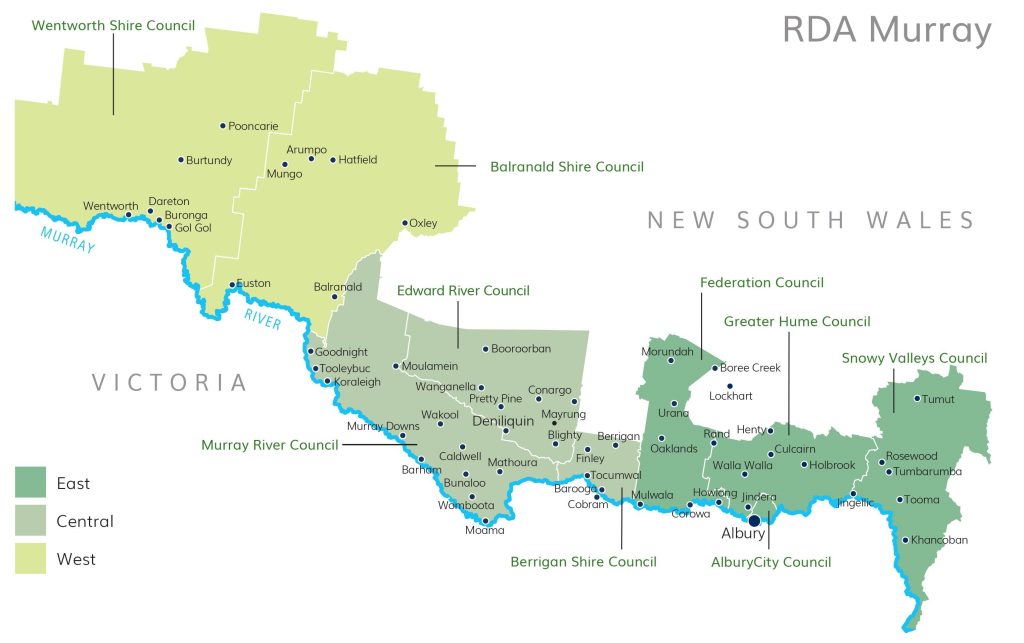
The Murray region covers an area stretching from the Snowy Valleys through to the South Australia border and includes the local government areas of:
The Murray region also includes parts of:
Population Centres
The main population centres in the Murray region are:
- Albury
- Balranald
- Barham
- Barooga
- Berrigan
- Buronga
- Corowa
- Culcairn
- Deniliquin
- Finley
- Henty
- Holbrook
- Howlong
- Moama
- Mulwala
- Tocumwal
- Tumbarumba

Postcodes for the Murray region
As a guide, we have compiled a list of postcodes for the Murray region here. As some of these may cross boundaries of Local Government Areas, and are subject to change, you must confirm these against the list of designated regional areas from the Department of Home Affairs.
BUSINESS CHAMBERS
If you’re looking for practical advice to help identify and understand your workplace challenges, contact the Local Business Chamber in your area:


